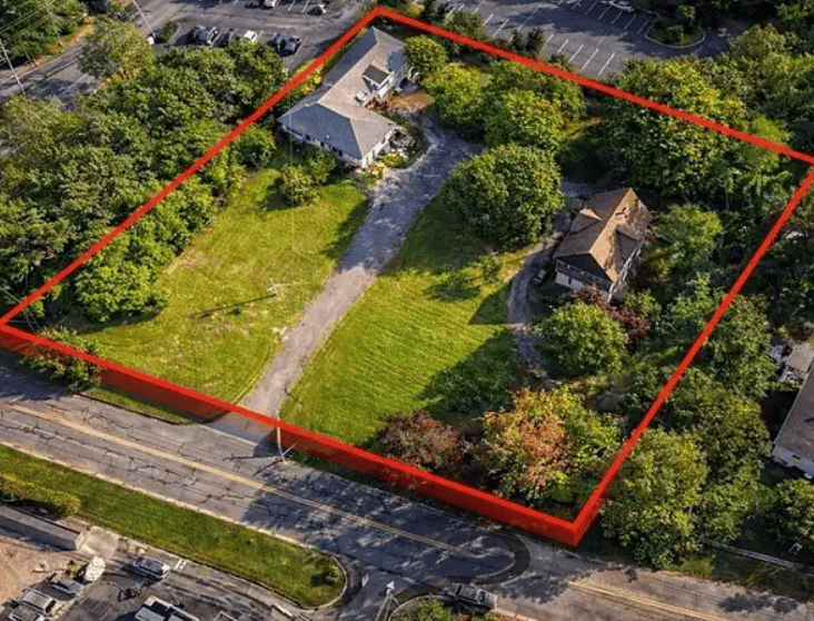
Two listings, both a short walk from moving water, both marketed with the same word. One sits on Sconticut Neck, facing open Buzzards Bay toward a sunset that never has to compete with a bridge or a breakwater. The other sits closer to town, along the Acushnet River shoreline near the inner harbor, in a neighborhood like Poverty Point where cottage-style homes have looked out at working boats for generations. Both listings will say "waterfront." Only one of them sits inside the boundary of an active federal Superfund site, with paperwork that has nothing to do with square footage or bedroom count.
That distinction rarely shows up in a listing description. It shows up later, when a buyer wants to replace a dock, extend a seawall, or find out why the town needs extra time on a shoreline permit. If you're looking at harbor-adjacent property in Fairhaven, the word "waterfront" tells you less than which side of the harbor line the parcel falls on.
The line runs through the harbor, not around the town
The New Bedford Harbor Superfund site covers roughly 18,000 acres of estuary stretching from the upper Acushnet River down into Buzzards Bay. The contamination dates back to two electronics manufacturers that discharged industrial waste containing PCBs into the harbor from the 1940s through the late 1970s, a practice that stopped only after federal manufacturing bans took effect. The Environmental Protection Agency placed the site on the National Priorities List in 1983, and the cleanup has run for decades since, addressed in stages covering a hot spot area, the upper and lower harbor, and the outer harbor toward the bay.
Subtidal dredging, the removal of contaminated sediment from below the harbor floor, wrapped up in March 2020 after pulling roughly one million cubic yards of PCB-laden material from the harbor bottom. That milestone gets cited often, and it's real, but it isn't the end of the story for shoreline property owners. Once the underwater dredging finished, EPA and the Army Corps of Engineers shifted attention to the shoreline itself. Documented work in 2021 specifically targeted areas south of Pleasant Street in Fairhaven and south of Belleville Road in New Bedford, removing contaminated soil from the shore and replanting it with native salt marsh grasses. That's five years back now, not decades, on a stretch of Fairhaven riverbank that borders residential streets.
What "inside the line" actually requires
For property owners along the harbor and river frontage, the cleanup left behind a set of institutional controls that stay in effect regardless of who owns the land next. Three matter most if you're buying, selling, or planning shoreline work in that zone.
- Shoreline development gets flagged before it gets permitted. EPA coordinates with the towns of Fairhaven, New Bedford, and Acushnet through the municipal wetland and coastal permitting process, so proposed construction along the upper and lower harbor gets checked against the cleanup remedy before it moves forward. A new dock, a rebuilt seawall, or shoreline fill in that zone may take a longer runway than the same project on the bay side of town.
- Part of the outer harbor is a federally regulated no-disturb zone. The Coast Guard designated the Outer Harbor Pilot Sediment cap area as a Regulated Navigation Area, which restricts anchoring, dragging, trawling, and spudding within it. It's marked on navigational charts, which matters if you're evaluating a property with deep-water mooring rights.
- Fish and shellfish advisories are still active. State restrictions continue to limit how much fish, shellfish, and lobster caught in and around the harbor is safe to eat, and EPA has said directly that seafood in the area will carry PCB contamination for some time yet. For a buyer picturing dinner off the dock, that's worth knowing before closing, not after.
These controls aren't static, either. In 2025, EPA proposed a seventh round of formal modifications to the harbor remedy, including language clarifying that the institutional controls apply specifically to preventing human contact with sediment that cleanup left in place rather than removed entirely. EPA held another public update meeting on the site in May 2026. This is a live regulatory process, not a closed file.
Where the bay side sits differently
None of this describes Sconticut Neck, West Island, or the Fort Phoenix shoreline, the addresses that carry Fairhaven's premium waterfront reputation and face open Buzzards Bay rather than the harbor and river. EPA's documented remediation work, the shoreline notification requirement, and the regulated navigation area all concentrate on the upper and lower harbor and the Acushnet River frontage north of Route 195, not on the bay-facing beaches that draw the town's highest per-foot demand. The contamination itself has been described as extending in varying degrees across roughly six miles of water from the upper river into the bay, but the active controls that actually change how a shoreline property gets used or permitted sit closer to the harbor than the bay.
That's the split that matters more than the word on the listing sheet. A parcel on Sconticut Neck and a parcel a few blocks from downtown Fairhaven can both be called waterfront and require entirely different conversations before you build anything, moor anything, or plan a summer of fishing off your own dock.
What this means for disclosure
Massachusetts doesn't require sellers to fill out a standardized property disclosure form the way some states do. But sellers still carry a legal duty to disclose material facts that could affect a buyer's decision, and real estate brokers have a separate obligation under Massachusetts General Laws Chapter 93A to disclose to a buyer anything that might reasonably affect that decision. Environmental hazards and title-affecting restrictions both fall inside that duty. If a parcel carries a recorded environmental restriction tied to the harbor cleanup, or sits inside the zone where shoreline construction requires coordination with EPA, that belongs in the disclosure conversation the same way a septic system or a known structural issue would.
This isn't a reason to avoid harbor-adjacent property in Fairhaven. It's a reason to ask the right question early, before an offer is drafted around a dock or seawall project that turns out to need a longer permitting timeline than expected. A title search and a conversation with a real estate attorney will surface whether a specific parcel carries a recorded restriction. A call to the town's conservation office will tell you whether your stretch of shoreline falls inside the notification zone. Neither step takes long, and both are far easier to handle before a purchase and sale agreement is signed than after.
A few questions before you call it waterfront
Does this affect every property in Fairhaven? No. The institutional controls tied to the New Bedford Harbor Superfund site apply to the harbor and Acushnet River shoreline, not to the town as a whole and not to the Buzzards Bay-facing side where Sconticut Neck, West Island, and Fort Phoenix sit.
Is the cleanup finished? The underwater dredging phase finished in 2020, but shoreline and saltmarsh remediation continued after that, with documented work near Pleasant Street in Fairhaven in 2021, and EPA proposed further modifications to the harbor remedy as recently as 2025. Treat it as an active process rather than a closed chapter.
Does this lower property values on the affected side? That's not a question a blog post can answer responsibly, and it shouldn't be. It depends on the specific parcel, what's recorded against the title, and what the current market is doing. An appraisal and a conversation with an agent who knows the difference between these two shorelines will tell you more than any general statement can.
If you're weighing a harbor-adjacent property in Fairhaven, whether you're buying, selling, or trying to understand what's recorded against a title you already hold, Susan Gorden Ryan Luxury can walk through what applies to your specific address before you sign anything. Request a complimentary home valuation and we'll start with the paperwork that actually matters for your shoreline.